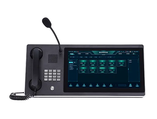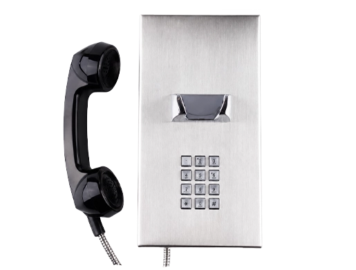
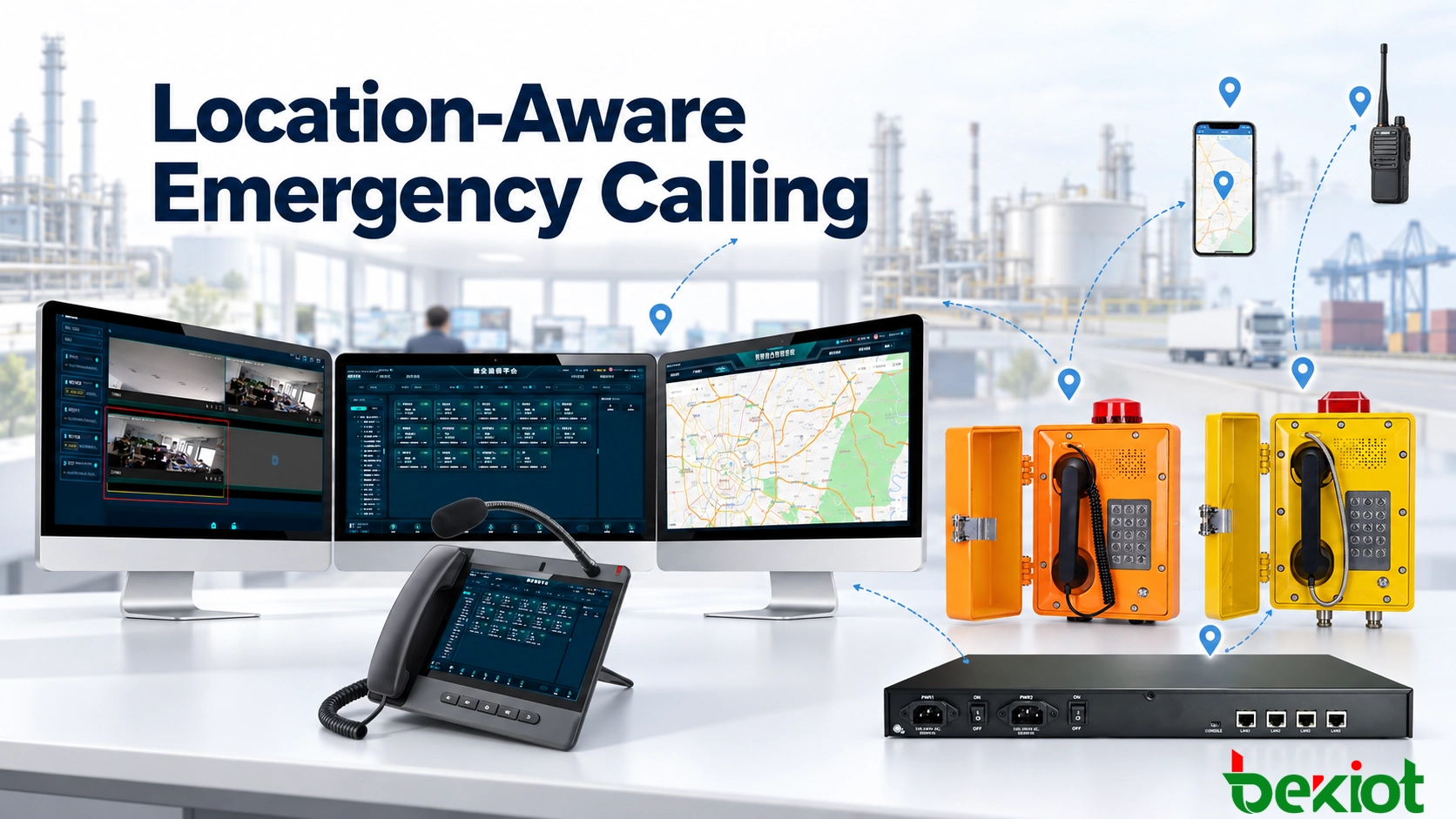
An emergency call reaches a command center from a field communication terminal. The SIP account identifies one facility, the asset database lists another installation point, and the mobile responder associated with the event is already moving away from both locations. Which position should the dispatcher trust?
Location-aware emergency calling is not simply a matter of placing a telephone icon on a GIS map. A command platform must determine who or what initiated the call, obtain location information from the available source, evaluate its accuracy and age, and present it in a form that operators can use without delay.
Fixed emergency phones, mobile applications, radio users and temporary communication terminals do not provide location in the same way. A reliable system therefore applies different identification methods, validation rules and fallback procedures to each endpoint type. It also makes uncertainty visible instead of presenting every position as equally accurate.
A Location Record Contains More Than Coordinates
Latitude and longitude are useful for placing an event on a map, but they are only part of the operational location. A dispatcher may also require the site name, building, floor, tunnel section, platform number, room, equipment area or nearest access point.
This distinction matters in industrial facilities, transport networks and large campuses. Geographic coordinates may direct a response team to the correct building while providing little guidance about which entrance to use or where the caller is located inside the structure. A descriptive location provides that missing context.
A complete location record also identifies how the position was obtained. A fixed emergency telephone may use an approved installation record. A mobile application may send a current GNSS position. A radio network may provide only a base-station coverage area. These sources do not have the same accuracy or operational meaning.
| Location field | Example | Operational value |
|---|---|---|
| Site | North Processing Plant | Identifies the responsible control team |
| Building or structure | Compressor Building 2 | Narrows the response area |
| Floor or zone | Level 3, Zone B | Guides responders inside the facility |
| Coordinates | Latitude and longitude | Places the event on the GIS map |
| Location source | Asset record, GNSS or network estimate | Shows how the position was obtained |
| Timestamp | Updated 12 seconds ago | Indicates whether the position is current |
| Accuracy | Estimated within 20 meters | Helps operators judge its practical usefulness |
| Verification state | Approved fixed installation | Shows whether the record has been confirmed |
The command interface presents the most important fields with the incoming call while keeping additional details available for verification. Operators can see not only where the marker appears, but also what the location represents and how recently it was obtained.
Different Endpoints Reveal Location Differently
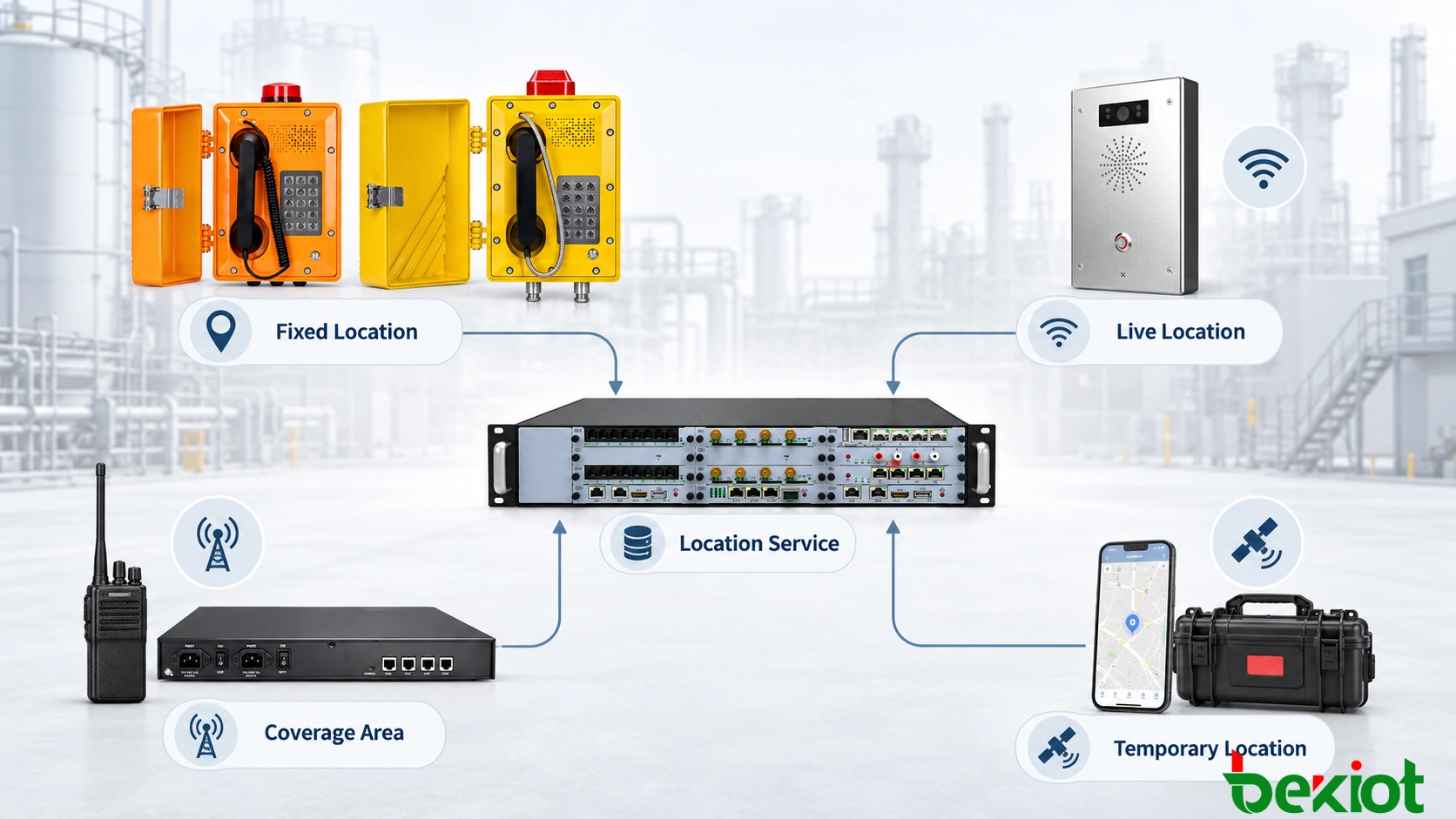
The method used to determine location depends on whether the caller is associated with a fixed device, a moving terminal, a radio network or temporary equipment. Treating all endpoints as if they provided real-time coordinates creates false confidence.
Fixed emergency phones and intercoms
A fixed industrial telephone, explosion-proof phone, passenger help point or SIP intercom usually has a known installation position. The device may be associated with a SIP account, extension number, MAC address, gateway port or asset identifier.
When a call arrives, the platform looks up that identity in an approved asset record. The resulting location may include a site, building, floor, zone, pole number, tunnel marker or map coordinate. The position remains reliable only while the asset record matches the physical installation.
Analog devices require a slightly different method. The platform may identify the telephone through the FXS gateway and port carrying the call. Each port then has a documented relationship with the connected field telephone. If cables or ports are changed without updating the database, the displayed location can be wrong even though the call works normally.
Mobile applications and smartphones
A mobile device can obtain its position through GNSS, Wi-Fi, cellular networks or a combination of sources. The application may send coordinates when the emergency function is activated and continue updating them while the incident remains active.
Mobile location is time-sensitive. A position received several minutes earlier may no longer describe where the user is now. The dispatch interface therefore shows the last update time and reported accuracy, particularly when the caller is moving.
Indoor areas, underground facilities and dense industrial structures can reduce GNSS performance. A mobile application may then rely on Wi-Fi positioning, cellular estimates or a previously known location. The operator must be able to distinguish these alternatives from a current high-accuracy reading.
Radio and push-to-talk users
Radio systems usually identify a user or terminal through a radio ID, call sign, talk group, handheld identity or vehicle-mounted unit. Some professional radio and PoC terminals can also report GNSS coordinates. Others provide only the base station, radio site or coverage area currently serving the terminal.
RoIP integration can make radio users reachable from a SIP-based dispatch platform, but a RoIP gateway does not automatically create precise location information. The available position depends on the radio network, terminal capability and interfaces provided by the radio management system.
If the platform knows only that a radio user is connected through a particular site or channel, the interface should display an estimated operating area rather than an exact point.
Temporary and portable communication equipment
Emergency command vehicles, portable satellite terminals, temporary SIP phones and rapidly deployed communication kits may move between incidents. Their location cannot remain permanently associated with the place where they were first configured.
A deployment procedure can require an authorized user to assign the current site, coordinates, responsible team and validity period before the equipment becomes active. When the temporary deployment ends, the record is closed or marked as expired.
This prevents a portable terminal used at one incident from appearing at the same location during a later deployment elsewhere.
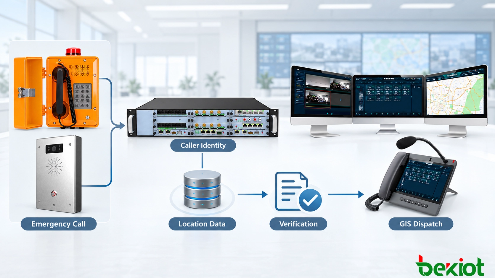
From Caller Identity to a Verified Position
Location processing begins when the communication platform receives a call or emergency event. The signaling layer provides an identity such as a SIP account, telephone number, device ID, gateway port or radio user ID. The platform uses that identity to search the appropriate location source.
A practical workflow can include the following steps:
The emergency call enters the SIP server, IP PBX or dispatch platform.
The platform reads the available caller and device identities.
The identity is matched with the asset database or user directory.
A fixed position or current mobile location is requested.
Available sources are compared according to predefined priority rules.
The timestamp, accuracy and verification state are checked.
The result is converted into a common GIS format.
The dispatch interface displays the location and its confidence information.
The call and position are attached to the same incident record.
The platform may receive several possible positions. For example, a mobile user account can have a registered office location, a last-known application position and a current GNSS reading. Source-selection rules determine which result appears first and which alternatives remain available for review.
A current, accurate GNSS position may be more useful than a registered office address. A verified fixed-terminal record may be more trustworthy than a weak network estimate. When the available information is old or inconsistent, the interface makes that limitation clear.
The platform should never present an estimated or outdated position as if it were a verified real-time location.
Location normalization is also required. One source may return geographic coordinates, another a building and floor, and another a radio coverage area. The dispatch platform translates these formats into a common operational view while preserving information about the original source.
Related Solution: IP Telephony Dispatch System for Command and Control Centers
Handling Missing, Stale and Conflicting Positions
Location errors are not always caused by positioning technology. Many begin with operational changes that were never reflected in the system. A telephone may be moved to another building, a gateway port may be reassigned, or a temporary terminal may retain the record from its previous deployment.
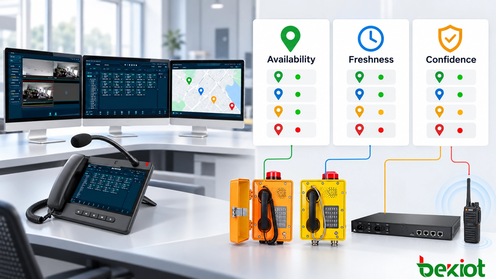
Mobile and radio locations create different problems. The last-known position may be several minutes old, GNSS and Wi-Fi sources may disagree, or the radio network may identify only a large coverage area. Instead of assigning one status to all of these conditions, the platform can evaluate location data across three separate dimensions.
| Dimension | Possible values | What it tells the operator |
|---|---|---|
| Availability | Available, Partial, Unavailable | Whether usable location information exists |
| Freshness | Live, Recent, Last verified, Stale | How current the position or its most recent verification is |
| Confidence | Verified, Estimated, Conflicting, Unconfirmed | How strongly the available evidence supports the position |
These dimensions can appear together. A mobile location may be available, live and estimated. A fixed installation record may be available and verified, with freshness represented by the date of its most recent physical or administrative verification. A last-known mobile position may be available but stale and unconfirmed.
| Combined condition | Example | Recommended operator action |
|---|---|---|
| Available + Live + Verified | Current mobile position confirmed by an approved source | Use as the primary dispatch position |
| Available + Live + Estimated | Current network-derived location with limited accuracy | Check the accuracy range and confirm if necessary |
| Available + Last verified + Verified | Fixed terminal checked against its physical installation record | Use while considering the most recent verification date |
| Available + Stale + Unconfirmed | Last-known position from several minutes earlier | Do not treat it as the caller's current position |
| Available + Recent + Conflicting | GNSS and Wi-Fi sources indicate different areas | Compare the sources and verify with the caller |
| Unavailable | No usable fixed, mobile or network position | Follow the manual location-confirmation procedure |
Position conflicts
If two sources disagree, the platform can compare their update time, accuracy, source type and verification history. The operator may see both positions rather than a single automatically selected point.
The difference can also reveal a configuration problem. If a fixed SIP phone reports an identity associated with another building, the asset database or endpoint configuration may be wrong. That condition should be recorded for correction after the incident.
Last-known location
A last-known location can still assist the response when current positioning is unavailable, but it must be labeled clearly. The display can show when the position was received and whether the user was moving at that time.
A position that was accurate ten minutes ago may be useful for a stationary maintenance vehicle but misleading for a person traveling through a transport hub. The acceptable age therefore depends on the endpoint and operating scenario.
Manual confirmation
Voice remains an important verification method. Operators can ask the caller to identify a building sign, equipment number, platform, tunnel marker or nearby landmark. The confirmed description can be added to the incident without overwriting the original system-generated data.
Keeping both records preserves traceability. Investigators can later see what the platform displayed, what the caller reported and which location the dispatcher used.
Turning Location Data into Dispatch Decisions
Location becomes useful when it changes what the command center does next. Once a usable position is available, the platform can select an operator, identify nearby resources and open the communication tools associated with that area.
Location-based call routing
Calls from different sites or service areas can be routed to the responsible dispatch group. A terminal in one plant may reach its local control room first, while an event from a remote station may go directly to a regional center.
Location-based routing also requires a fallback path. If the responsible group is unavailable, the call can move to an alternate operator without losing its original site, source and position information.
Nearby cameras and field resources
The position can identify cameras, alarm inputs, access points, paging zones and radio groups associated with the incident area. Instead of searching several systems, the operator receives a focused set of relevant resources.
A map can also show response personnel, vehicles, site entrances and restricted areas. The dispatcher can then evaluate which team is both close enough and qualified to respond.
The nearest responder may not be the correct responder if access restrictions, hazardous zones, equipment qualifications or blocked routes are not considered.
Area notification and coordinated response
An emergency position can be matched with a broadcast zone so that instructions reach the affected area without disturbing unrelated sites. The same event may also be sent to a local radio group, maintenance team or security unit.
Calls, maps, video, alarms, recordings and dispatch actions remain associated with one incident identifier. This gives the command center a continuous record from the first call through verification, response and closure.
Reliability, Security and Verification
Location-aware calling introduces dependencies beyond the voice path. A call may still connect when the GIS server, asset database or positioning service is unavailable. The system therefore requires a defined degraded operating mode.
If a live position cannot be retrieved, the platform may display the last verified fixed record or a locally cached site description. If the map service fails, the operator can still receive the building, zone and terminal name as text. Failure of the location service must not prevent the emergency call from being answered.
Protecting location records
Unauthorized or accidental changes to location data can send responders to the wrong place. Asset records, gateway-port mappings and temporary deployment positions require role-based access and change logging.
Each modification can record the previous value, new value, operator, time and reason for the change. Mobile location data also requires controlled access because it may reveal the movement of personnel or vehicles.
Maintaining fixed-device records
Fixed emergency terminals require periodic verification. Records should also be checked after building changes, equipment replacement, network migration, gateway rewiring or relocation of a telephone or intercom.
A practical inspection compares the physical label, SIP account, gateway port, asset number, descriptive location and GIS marker. Any mismatch is corrected before the terminal returns to service.
Testing the complete workflow
Commissioning must test more than whether a map icon appears. Recommended scenarios include:
Calling from a fixed industrial telephone and verifying its registered position
Calling through an analog gateway after changing the connected port
Moving a mobile terminal while an emergency event remains active
Providing an intentionally outdated mobile position
Sending conflicting GNSS and Wi-Fi location results
Testing a radio user with only coverage-area information
Deploying a temporary terminal at a new incident location
Disabling the GIS service while keeping voice communication available
Interrupting access to the central asset database
Verifying that nearby cameras and paging zones match the event location
Checking permissions and logs for location-record changes
Confirming that recordings and location data remain attached to the same incident
Location-aware emergency calling is useful only when the displayed position can be understood and trusted. A map marker without a verified identity, timestamp or source may create false confidence and send responders in the wrong direction.
A dependable command-center design connects caller identity, fixed asset records, live positioning services and GIS operations through one controlled workflow. It also makes uncertainty visible, allowing dispatchers to distinguish a verified position from an estimate, an outdated record or a location that still requires confirmation.
FAQ
Can several command centers share the same location records?
Yes. Central, regional and local command centers can use a shared location database or synchronized records. The architecture must define which system owns the master record, how updates are distributed and how conflicts are handled when two centers modify the same information.
How should indoor floor plans be kept aligned with GIS data?
Floor plans and GIS markers should use consistent building, floor, room and device identifiers. When a layout changes, the drawing version, asset location and emergency response map should be updated through the same change-control process and verified at the site.
What happens when response organizations use different map systems?
The participating systems need a common way to exchange coordinates, site identifiers and descriptive location fields. Transformation between map formats should be tested so that the same incident does not appear in different positions on separate command platforms.
Who should approve the location of a temporary terminal?
Approval can be assigned to an authorized site supervisor, communications administrator or incident command role. The record should include the deployment location, responsible person, activation time and expiry condition so that outdated temporary positions are not reused.
Can location-aware calling work without continuous employee tracking?
Yes. Fixed devices can use registered installation records, while mobile location may be collected only when an emergency function is activated or when an authorized operational workflow requires it. The collection method should match the actual safety requirement and access should remain restricted.